Postcard story maps
One of the objectives of Know Your Bristol On The Move has been to enhance Know Your Place by adding new layers of images from the city archives held at Bristol Record Office. These images include some of the 9000 historic postcards held in the Vaughan collection. So far over 1000 images have been added by a team of volunteers to a specific layer on the website.
These postcards many dating to the early decades of the twentieth century are literally a unique snapshot of the city streets and cover neighbourhoods across the city that many communities will recognise. Often the postcard images capture individual shops, houses, churches or views along everyday streets.
Roy Vaughan who originally collected these postcards organised his collection into themes that are often area based. This means that as the volunteers add the scanned images from each theme to the map we are beginning to reveal a comprehensive picture of these neighbourhoods.
To better reveal this picture and tell the stories that the volunteers are uncovering about each postcard and place we are creating story maps about some of the neighbourhoods. These enable users to view a selection of images alongside an early 1900s map in the form of a tour around the streets.
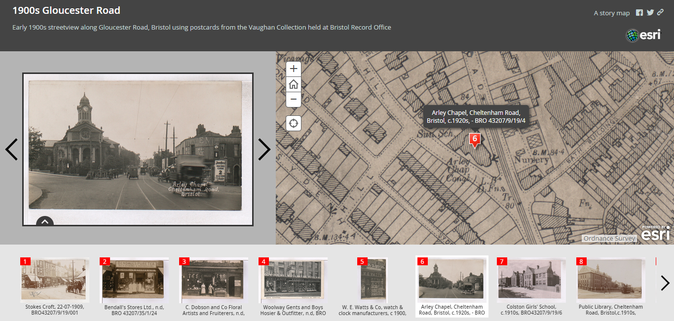
We have created story maps for Bedminster, Southville and Gloucester Road. The latter is comprehensive enough to act almost like a 1900s Google Streetview.
Over the coming months as more images are added we’ll create more of these story maps for other neighbourhoods.